Hexagon unit Leica Geosystems has boosted the efficiency of hydrographic survey systems with upgrades of Leica Chiroptera 4X and Leica HawkEye 4X.
The latest upgrades roll out a new bathymetric LiDAR high-resolution technology that boosts the bathymetric point density by a factor four.
Go deeper with GlobalData

Due to this higher point density, customers can deliver high-resolution products at reduced operational costs.
For typical bathymetric LiDAR end-user specifications, flight cost savings of 50% could be achieved.
With the new technology, the depth penetration increases up to 10% without impacting the turbid water performance or precise factor.
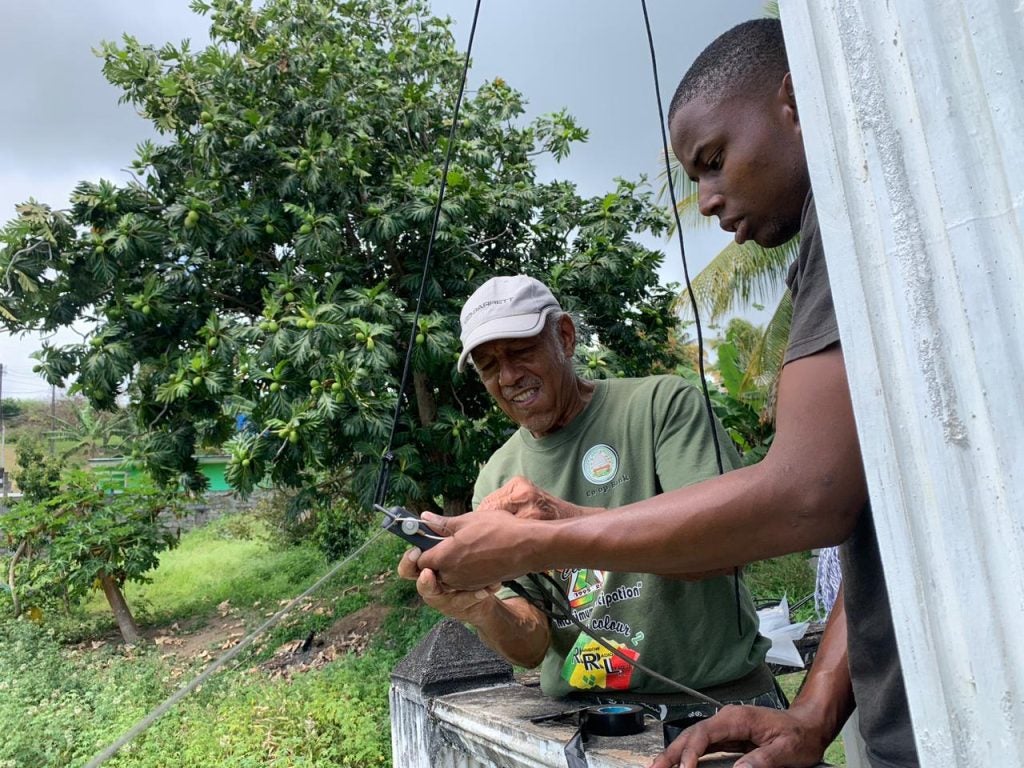
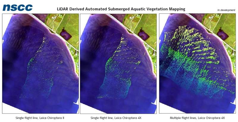
The Chiroptera 4X bathymetric high-resolution technology is being validated by Nova Scotia Community College in test projects on Canada’s east coast in turbid water conditions.
How well do you really know your competitors?
Access the most comprehensive Company Profiles on the market, powered by GlobalData. Save hours of research. Gain competitive edge.

Thank you!
Your download email will arrive shortly
Not ready to buy yet? Download a free sample
We are confident about the unique quality of our Company Profiles. However, we want you to make the most beneficial decision for your business, so we offer a free sample that you can download by submitting the below form
By GlobalDataNova Scotia Community College Applied Geomatics Research Group (AGRG) Centre of Geographic Sciences research scientist Tim Webster said: “The four times increased resolution dramatically improves our ability to detect objects, even on the scale of features 1m x 1m, where the increased number of points can be used to further clarify the object’s location and details.
“For vegetation mapping, the increased resolution of the sensor provides us an unprecedented level of detail related to vegetation and other materials on the seafloor. We have also detected new seabed features not discovered from previous bathy LiDAR surveys in the same area, which indicates an increased sensitivity of the solution.”
The 4X technology, which is an upgrade package to all present Chiroptera II and HawkEye III customers, will be integrated in all new bathymetric LiDAR systems.
With improved resolution, depth penetration and accuracy, it is possible to achieve benefits in environmental and coastal monitoring, inland waters mapping, infrastructure planning, and near-shore applications with hydrographic survey systems.
Typical end-user specifications need two to four points per square metre for the highest quality level shallow bathymetric LiDAR data, which is possible to be achieved with a single flight line with the new Chiroptera 4X or HawkEye 4X shallow channel. In the previous generation, double coverage was required. Due to this improvement, half of the flight costs are saved.
The new 4X technology, with a depth penetration of 2.7/k and collection of 140,000 points per second of the Chiroptera or HawkEye shallow channel, is claimed to provide a high shallow water performance with regard to point density, turbid water performance and depth penetration.
For the HawkEye deep channel, the 40,000 points per second collection can easily deliver IHO order 1B data from a single flight line.
Hexagon’s Geospatial Content Solutions Airborne Bathymetric LiDAR vice-president Anders Ekelund said: “Optimising a bathymetric LiDAR system has always been a trade-off between sensitivity (depth penetration) and resolution. Our new 4X high-resolution technology allows us to improve both those parameters without any tradeoffs.
“Performing advanced high-density site surveying allows users to extract better details for both above-water and underwater features, increasing our knowledge of coastal and inland waterways and habitats.”