Sonardyne International has partnered with Guidance Marine to jointly develop a new solution that will enable the unmanned autonomous vessels to navigate safely even when they lose contact with global navigation satellite systems (GNSS).
The collaborative project, dubbed AutoMINDER (Autonomous MarIne Navigation in Denied EnviRonments), is supported by the UK’s innovation agency Innovate UK.
As per the agreement, Sonardyne’s underwater positioning systems will be clubbed with Guidance Marine’s relative surface positioning systems to create one integrated platform.
The system will leverage Sonarydne’s all-in-one subsea navigation instrument SPRINT-Nav, which combines several Sonardyne solutions such as SPRINT INS, Syrinx doppler velocity log (DVL) and a high-accuracy pressure sensor.
It enables accurate acoustic-aided positioning by integrating sensor data from Syrinx DVL and/or other data provided by acoustic positioning instruments.
The system will receive position data from Guidance Marine’s vessel-mounted CyScan laser instrument, which is developed to calculate the vessel’s position and maintain positioning between targets.
How well do you really know your competitors?
Access the most comprehensive Company Profiles on the market, powered by GlobalData. Save hours of research. Gain competitive edge.

Thank you!
Your download email will arrive shortly
Not ready to buy yet? Download a free sample
We are confident about the unique quality of our Company Profiles. However, we want you to make the most beneficial decision for your business, so we offer a free sample that you can download by submitting the below form
By GlobalDataSonardyne International Marine Vessel Systems global business manager Derek Lynch said: “By proving and demonstrating these technologies, we will enable autonomous vessels to behave in a safe and predictable manner beyond the point at which existing systems revert to human control.
“This will include safe, reliable positioning in the event of a sensor failure such as the denial of GNSS, which is becoming ever-more common, and enhanced positioning to enable moving in challenging and complex environments.”
The project will also see the creation of a common interface structure by combining feeds from different sensors into one platform, as well as develop an industry standard.
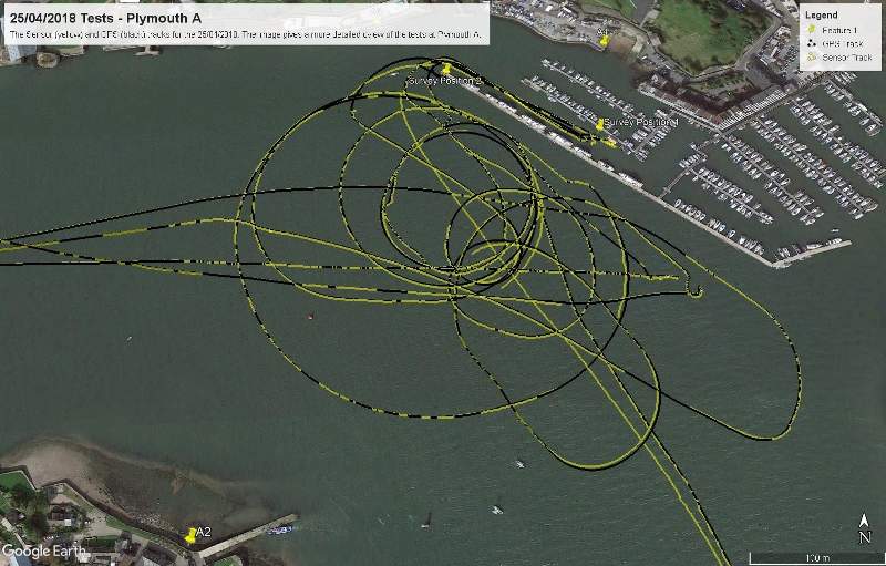
Earlier this year, a series of tests were conducted in the UK as part of the AutoMINDER project.
The tests saw the mounting of CyScan on Sonardyne’s Echo Explorer survey vessel to add extra GeoLock functionality.
The project aims to carry out new trials later this year. The trials will use Sonardyne instruments to provide water track velocity data in order to further improve the inertial navigation system (INS) positioning.


