
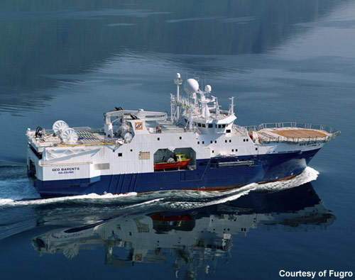
The Geo Barents seismic survey vessel is part of the Fugro fleet and was constructed at the Solstrand shipyard in Tomrefjord, Norway. The vessel was converted from the hull of a fishing trawler originally built at Braila in Romania. In 2006, the steel hull was extended increasing the number of berths from 30 to 49. The ship was named in April 2007 prior to handover to the new owners.
The vessel is undertaking a work/operations programme on the Stanley 3D project for TGS-NOPEC Geophysical Company in the Gulf of Mexico, which will take between 1.5 and 2.5 years to complete. The ship is being chartered and operated for Fugro by Uksnøy & Co of Norway for a three-year period. Fugro will obtain ownership in November 2010.
Recommended Buyers Guides
Technical
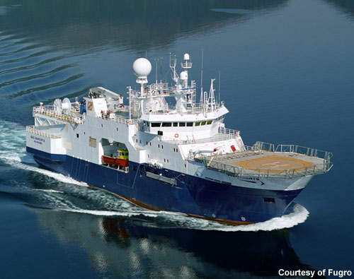
The Geo Barents is registered in Norway and has the notation 1A1 SF COMF-V (3) HELDK-SH E0. The ship has a gross tonnage of 4,979t, a net tonnage of 1,494t, and a deadweight of 1,293t. The overall length of the ship is 76.95m, the length between the perpendiculars is 61.8m, the load line length is 67.046m, the moulded breadth is 21.034m and the draught is 6.85m.
Four main diesel generators and one emergency diesel generator were supplied by Cummins Inc. The ship uses two UF63 LTC-1750 tunnel thrusters (forward and aft) and a retractable azimuth system to manoeuvre. The main propulsion is from two Anglo Belgian Corporation NV 12VDZC diesel units using a plain bearing shaft to a Finnøy Gear & Propeller AS supplied transmission gear and controllable pitch propeller.
Equipment
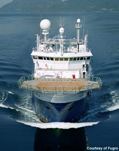
The Geo Barents has a digital gun system, a 240m² cable-repair facility and an onboard survey instrument room. Other facilities include an aluminium helicopter deck with direct access to the ship’s hospital and a high vision bridge with a full array of navigational and survey equipment. Primary navigation for the vessel uses Fugro Starfix.HP DGPS and secondary navigation uses Fugro Skyfix.XP DGPS.
The ship’s six seismic streamers are Sercel Seal oil filled units with an individual maximum capacity of 9,000m. The primary seismic source is a Sodera G-gun (single source up to 8,000in³ and dual source up to 4,000in³) configured to a single source. Recording uses a Sercel Seal 24-bit digital system in conjunction with ARGUS data recording and the online QC Processing Software is FSI Uniseis and Paradigm Focus with SGI Origin series hardware.
Orca technology
The Geo Barents has been equipped with a special command and control system called Orca provided by Concept Systems Ltd (a subsidiary of Input/Output of the US). This system will be able to manage data workflows onboard the seismic survey vessel, which will operate with steerable streamers. The system will allow large streamer spreads and can be configured for complex acquisition programmes, including 4D repeat surveys where the positional accuracy is crucial for success.
The Orca system is able to manage both navigation and seismic data acquisition and provides quality control for the acquired data so that there is no requirement for constant monitoring by the operator and error alerts.