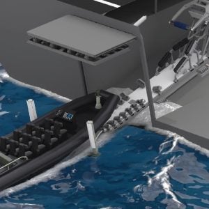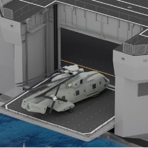
Project Mapping Landing Aid (PMLA)
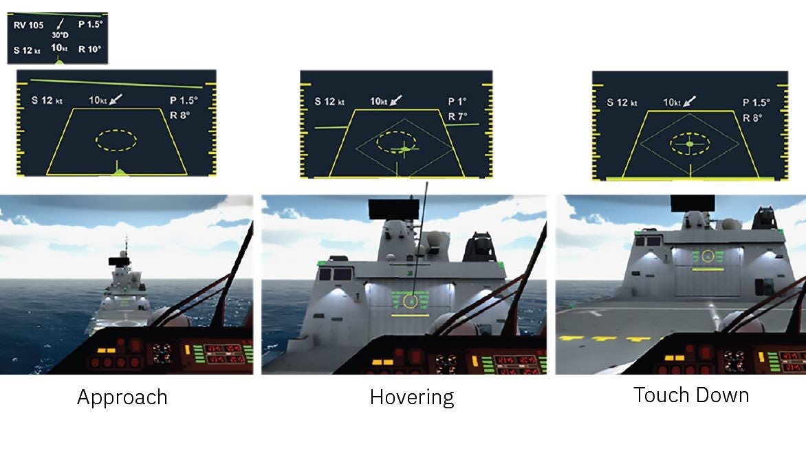
The projection mapping landing aid superimposes an image of the landing scenario onto the hangar face so that the pilot can have situational awareness as they land. The image integrates relevant sensing data, augmenting the perception of the pilot.
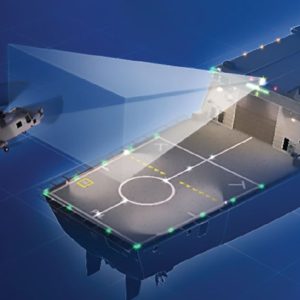
Main features
- Approach alignment indication
3D helicopter positioning:
- Position on deck
- Altitude over deck
- Horizon reference, integrated in the altitude indication
Scenario data:
- Environment (wind speed and direction)
- Navigation (course, speed and attitude)
- Manoeuvre data recording